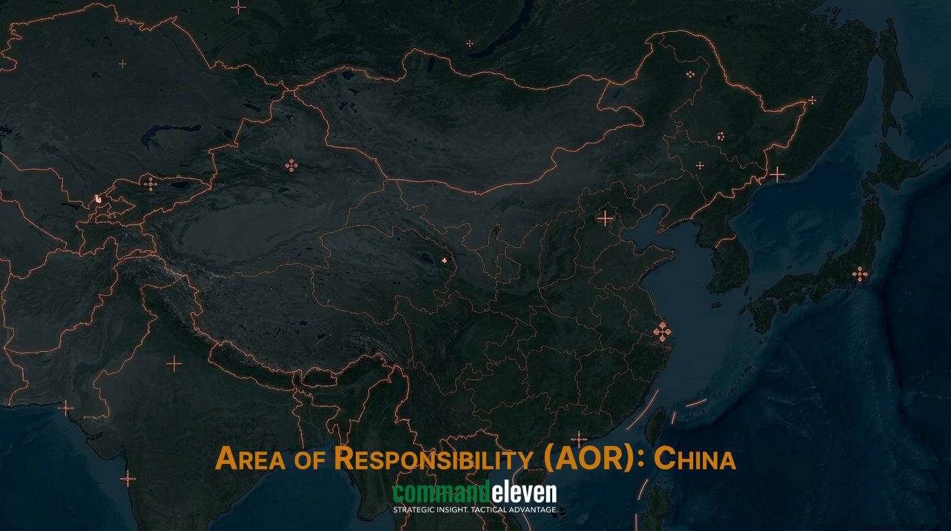
Executive Summary & Tactical Environment
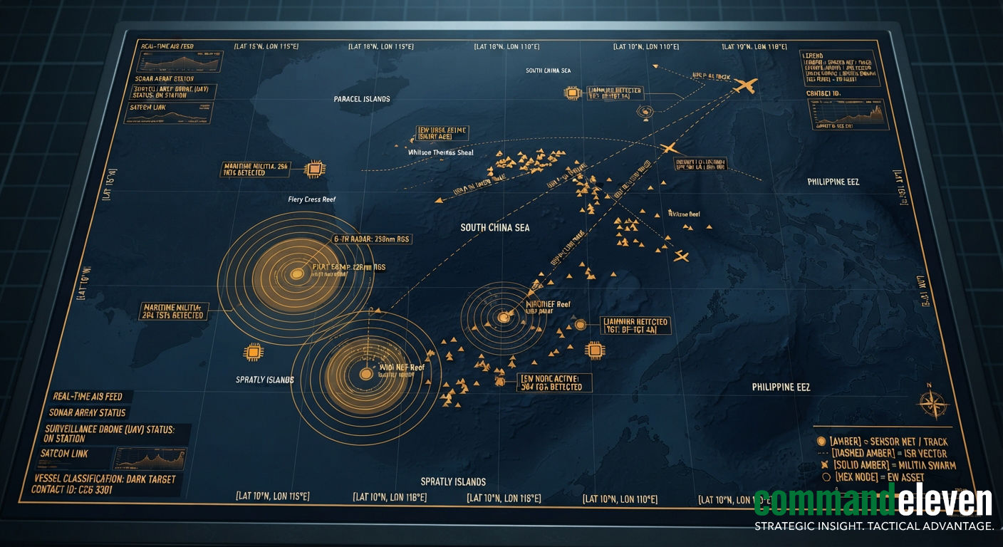
The South China Sea (SCS) serves as a primary friction point for major-power competition, characterized by the People’s Republic of China’s (PRC) deployment of an integrated, multi-layered Maritime Domain Awareness (MDA) and Anti-Access/Area-Denial (A2/AD) framework. Through the artificial militarization of features in the Spratly and Paracel Island chains, Beijing has established an overlapping sensor and fire-control envelope extending across the entirety of the “Nine-Dash Line.”
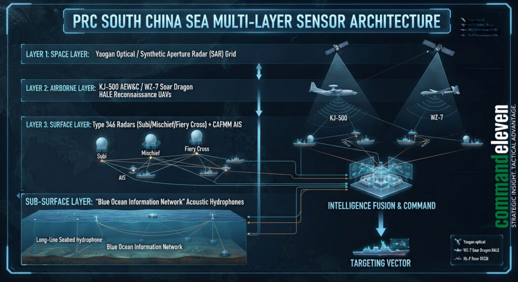
This network integrates fixed terrestrial radar arrays, sub-surface acoustic monitoring grids, high-altitude long-endurance (HALE) uncrewed aerial vehicles (UAVs), and satellite-linked commercial fishing fleets operating as the Armed Forces Maritime Militia (CAFMM). In response, a coalition of Western and Indo-Pacific nations,led by the United States, Philippines, Japan, and Australia,has deployed networked ISR capabilities and joint maritime patrols to preserve international freedom of navigation and counter gray-zone coercion.
PRC Outpost Militarization & Sensor Topologies
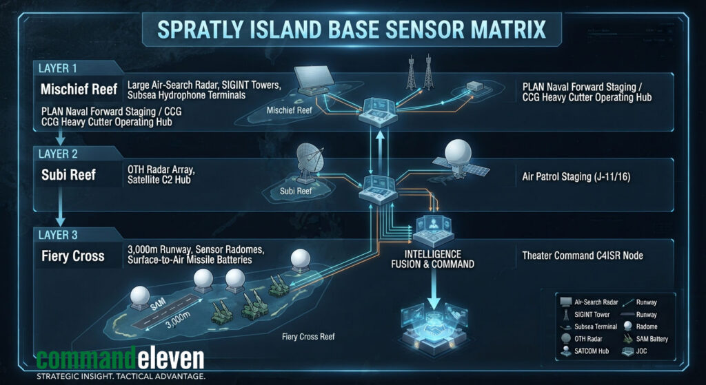
The transformed reefs of Mischief, Subi, and Fiery Cross function as primary operational nodes for the People’s Liberation Army Navy (PLAN) and China Coast Guard (CCG).
Radar and ELINT Sensor Facilities
- Over-The-Horizon (OTH) and High-Frequency Radars: Fixed installations on Subi and Mischief Reefs feature large phased-array radars capable of tracking surface combatants and aerial targets beyond the conventional radio horizon, extending target-acquisition envelopes past the First Island Chain.
- Signals Intelligence (SIGINT) Radomes: Dense radome clusters collect, catalog, and triangulate electromagnetic emissions from allied naval platforms, commercial shipping, and regional sovereign aircraft operating throughout the Palawan and Luzon Straits.
Sub-Surface “Blue Ocean Information Network”
Beijing has deployed a distributed underwater acoustic sensor network across the sea floor connecting the Paracel Islands, Spratly Islands, and Hainan Island:
- Acoustic Hydrophone Lines: Fixed, bottom-mounted hydrophone arrays monitor strategic underwater chokepoints,including the Bashi Channel and Mindoro Strait,detecting acoustic signatures of foreign attack submarines (SSNs) and ballistic missile submarines (SSBNs) entering the SCS basin.
Maritime Militia Architecture & AIS Obfuscation Dynamics
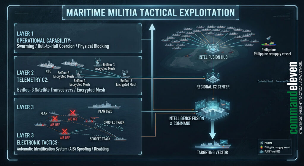
The Chinese People’s Armed Forces Maritime Militia (CAFMM) provides Beijing with a scalable tool for gray-zone operational control, denying physical access to disputed shoals (e.g., Second Thomas Shoal, Scarborough Shoal, Sabina Shoal) while maintaining a threshold below open kinetic conflict.
Fleet Organization & Beidou-3 Integration
- Spratly Backbone Fleets: Purpose-built, steel-hulled commercial fishing vessels equipped with high-capacity water cannons, reinforced stems for ramming, and specialized communications hardware operate out of Guangdong and Hainan ports.
- BeiDou-3 Command Links: Transceivers installed on CAFMM vessels allow real-time tactical direction from CCG and PLAN operational centers, enabling rapid swarm aggregation against targeted Philippine resupply missions or allied survey vessels.
Automatic Identification System (AIS) Manipulation
To evade international tracking and obscure coordinated swarming actions, militia vessels utilize sophisticated AIS manipulation techniques:
- Identity Spoofing & Dark Fleet Operations: Vessels intentionally disable AIS transponders (“going dark”) during active interdiction operations or clone the Maritime Mobile Service Identity (MMSI) numbers of passive commercial cargo vessels, creating false maritime operational pictures on open-source intelligence platforms.
Allied ISR Counter-Postures & Maritime Domain Awareness Networks
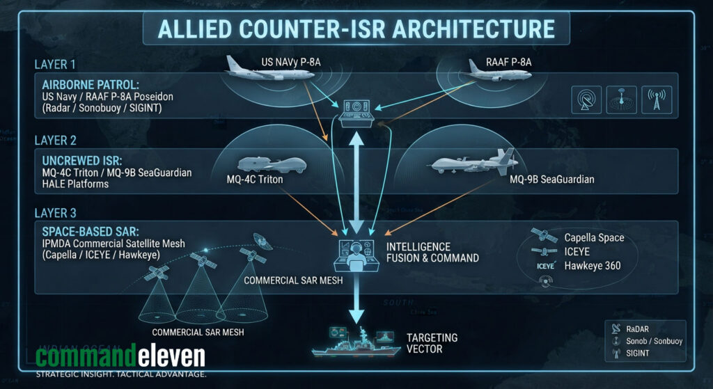
To neutralize the PRC’s domain visibility advantage, allied nations have developed a synchronized ISR network leveraging airborne, space-based, and uncrewed platforms.
Networked Airborne and Uncrewed Assets
- Boeing P-8A Poseidon Operations: Operating continuously out of bases in the Philippines, Japan, and Australia, P-8A platforms deploy active multi-static sonobuoy fields to track PLAN sub-surface assets while utilizing APY-10 multi-mission maritime search radar to monitor surface fleet distributions.
- HALE Uncrewed Integration: US Navy MQ-4C Tritons and Japanese/Philippine MQ-9B SeaGuardians deliver 24-hour un-interrupted radar and optical coverage across contested operational sectors, feeding raw sensor data into ground processing nodes.
Indo-Pacific Maritime Domain Awareness (IPMDA) Initiative
The Quad-backed IPMDA initiative integrates commercial space-based Synthetic Aperture Radar (SAR) constellations (e.g., Capella Space, ICEYE) and radio frequency (RF) emission tracking satellites (e.g., HawkEye 360):
- Dark Vessel Detection: SAR satellites penetrate cloud cover and night conditions to identify the physical hulls of dark-operating militia vessels, cross-referencing SAR returns against real-time AIS feeds to automatically flag spoofed or un-flagged combatants.
Strategic Outlook & Baseline Indicators
The maritime operational environment in the South China Sea will remain locked in a high-intensity standoff through H2 2026.
Key indicators to track include:
- Sabina & Second Thomas Shoal Encirclement Ratios: The concentration ratio of CCG and CAFMM vessels deployed around Philippine Outposts relative to escorting Philippine Navy/Coast Guard hulls.
- Permanent PLAN Deployment to Reclaimed Features: The transition from temporary rotational forward deployments of PLAN strike fighters (J-15, J-16) to permanent combat aircraft basing across the Spratly airfields.
- Sub-surface Hydrophone Grid Expansion: The deployment of additional acoustic sensor arrays toward the Mindoro and Lombok Straits to monitor allied submarine movements.