
Technical Takeaways
- Sovereign Gridlock and Strategic Access Risks: The indefinite freezing of the UK-Mauritius Treaty in early 2026,driven by the United States withdrawing its formal administrative backing,preserves short-term Anglo-American control over Diego Garcia but creates an acute long-term operational liability. The resulting legislative impasse leaves the base exposed to future Mauritian airspace denials and international legal challenges that could disrupt strategic strike timelines during active theater contingencies.
- Littoral Fusion and Interoperability Mandates: The operationalization of India’s forward operating base on North Agalega Island creates a highly capable southwestern sentinel that complements Diego Garcia’s strike envelope. However, maximizing this choke-point interception wall requires overcoming deep data-siloing and standardizing tactical encrypted data-links to achieve a seamless common operational picture across coalition forces.
- A2/AD Subsurface and Hypersonic Vulnerabilities: The physical permanence of Diego Garcia leaves its fixed airfield, fuel infrastructure, and GEODSS arrays highly vulnerable to Chinese long-range precision threat vectors, such as the PLARF’s hypersonic DF-26B and DF-27 missiles. This kinetic threat is coupled with advanced PLAN subsurface protocols that leverage regional bathymetric anomalies and autonomous underwater glider swarms to systematically degrade the atoll’s passive sonar detection networks.
Geopolitical Cession, Sovereign Fragmentation, and Dual-Authority Jurisdictional Risks
The signing of the UK-Mauritius Treaty in May 2025 fundamentally restructured the sovereign architecture of the Chagos Archipelago, introducing unprecedented multi-layered jurisdictional volatility into the central Indian Ocean Region (IOR). Under the framework of this agreement, the United Kingdom ceded full de jure sovereignty over the archipelago,including the critical atoll of Diego Garcia,to the Republic of Mauritius. This act dismantled the unified administrative envelope of the British Indian Ocean Territory (BIOT) and substituted a split-authority leaseback mechanism.
The structural mechanics of this treaty establish a dual-authority matrix that compromises traditional operational security (OPSEC) boundaries:
- The 99-Year Military Leasehold: The United Kingdom retains immediate administrative, civil, and criminal jurisdiction over a carved-out envelope comprising the landmass and a 12-nautical-mile territorial sea surrounding Diego Garcia. This lease runs for an initial 99-year term, with an unliquidated annual payment averaging 101 million pounds ($136 million) underwritten by London to Port Louis.
- The Outer Islands Demarcation: Mauritius exercises direct, unhindered administrative control over the remaining features of the archipelago, including Peros Banhos and the Salomon Islands. While the treaty incorporates a strict exclusion clause prohibiting foreign security forces from establishing footprints on these outer features without joint UK-US authorization, the physical monitoring of this non-demarcated maritime space introduces significant operational friction.
This structural fragmentation has triggered severe diplomatic and military friction between London and Washington. Throughout early 2026, the second Trump administration heavily criticized the Starmer government’s cession, defining it as a significant strategic liability that introduces a foreign sovereign intermediary into the United States’ primary logistics hub in the IOR.
The friction escalated operationally during recent joint US-Israeli kinetic actions in the Middle East. US strategic command channels experienced critical operational delays when the UK government paused processing flight clearances for B-2 Spirit and B-52H Stratofortress long-range bombers staging from Diego Garcia. This pause stemmed from British legal maneuvers to vet the target profiles against international humanitarian law and the specific boundaries of the 1966 and 2025 bilateral protocols, demonstrating that Mauritian sovereignty,combined with British statutory compliance,acts as an administrative checkpoint rather than an unhindered power-projection platform.
Technical Specifications of Diego Garcia as an Unsinkable Aircraft Carrier and Undersea Warfare Hub
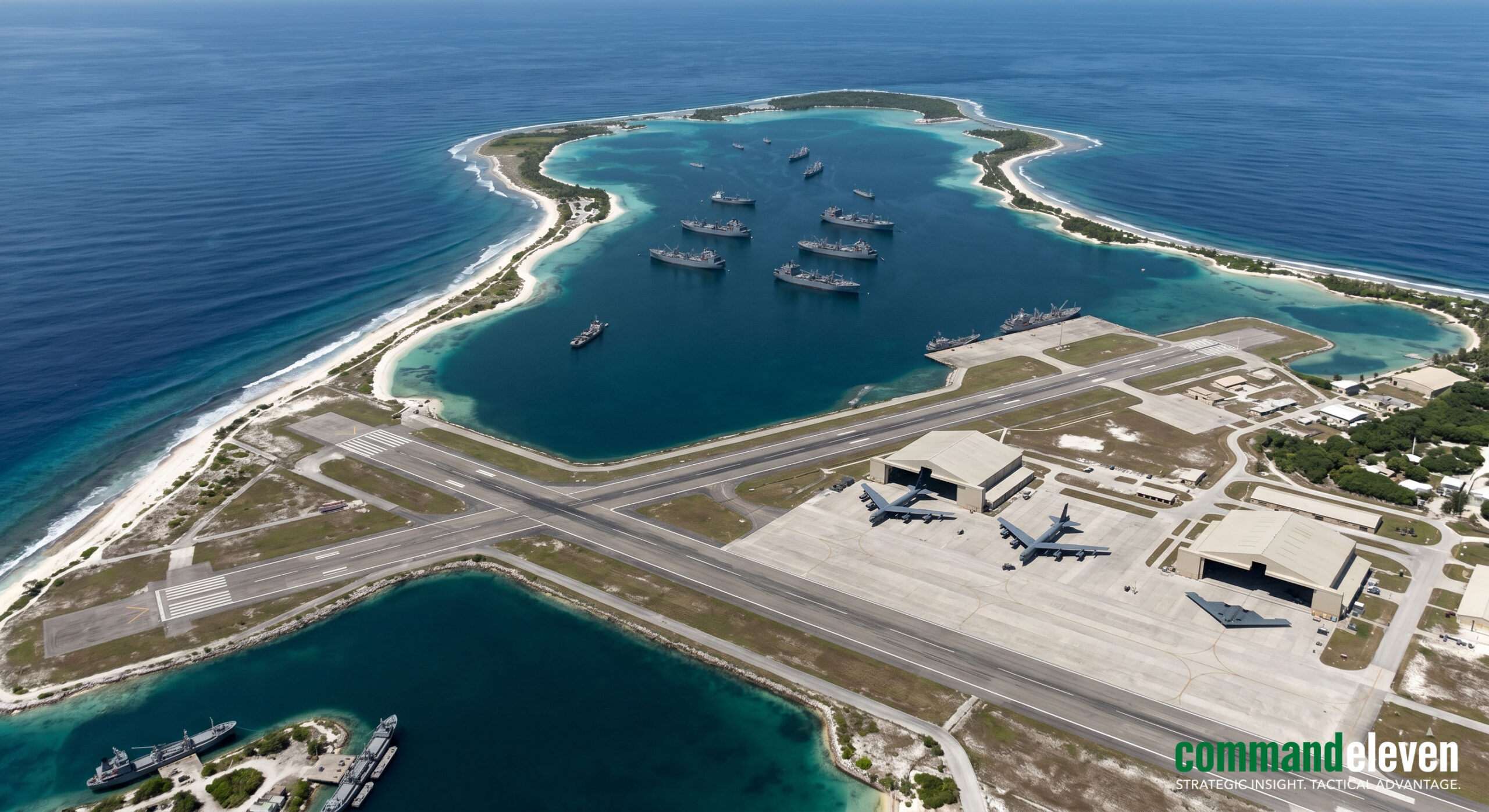
Diego Garcia functions as the geostrategic pivot of the United States Indo-Pacific Command (USINDOPACOM) and United States Central Command (USCENTCOM) intersection, sitting roughly equidistant (~3,000 kilometers) from the critical choke points of the Bab-el-Mandeb Strait and the Strait of Malacca. The physical footprint of the atoll has been highly optimized to support multi-domain strategic strike campaigns and continuous undersea warfare monitoring.
Strategic Air Power Infrastructure
The airfield architecture at Diego Garcia is engineered to support maximum-gross-weight takeoffs for heavy strategic bombers and sustained aerial refueling orbits:
- Runway Matrix: The installation features two contiguous 12,000-foot (3,650-meter) asphalt/concrete runways configured with high-load bearing capacities capable of handling continuous operations by USAF B-2, B-52H, and B-1B Lancer bomber fleets.
- Fuel and Logistics Storage: The base maintains the largest Type III fuel hydrant system in the US military inventory, linked directly to bulk petroleum, oil, and lubricants (POL) storage tanks holding over 1.3 million barrels of aviation turbine fuel. This is complemented by specialized Climate-Controlled Forward Operating Location (FOL) hangars fitted with environmental control systems designed to maintain the radar-absorbent material (RAM) coatings of stealth aircraft.
Deep-Water Naval Support and Undersea Dominance
The interior lagoon of the atoll has been dredged to a nominal depth of 45 feet (13.7 meters), forming a protected deep-water anchorage optimized for the forward deployment of Military Sealift Command (MSC) Prepositioning Ships and advanced submarine warfare assets:
- Submarine Tender and SSGN Support: The naval facility frequently hosts US Navy Submarine Tenders (such as the Emory S. Land-class, AS-40) alongside Ohio-class Guided Missile Submarines (SSGNs). The deep-water piers are structurally integrated with automated vertical-launch system (VLS) rearming infrastructure, allowing for the rapid reloading of up to 154 Tomahawk Land Attack Missiles (TLAM) per hull without returning to continental US ports.
- Autonomous Undersea Vehicle (AUV) Integration: In line with 2026 technological integration mandates, the Diego Garcia naval base has been retrofitted with dedicated launch, recovery, and maintenance facilities for extra-large autonomous undersea vehicles (XLUAVs), specifically the Boeing Orca platform. These systems execute automated, long-endurance acoustic mapping and sensor-seeding missions throughout the chokepoints of the southwestern littoral zones.
- Space and Sensor Architecture: The base hosts a critical node of the Ground-based Electro-Optical Deep Space Surveillance (GEODSS) system, tracking deep-space satellites and orbital debris, alongside high-frequency trans-horizon tracking radars and automated data-link transceivers that funnel real-time target coordination data directly into the Palantir Maven Smart System network.
Regional Surveillance Networks, Forward Littoral Basing, and the Agalega Axis
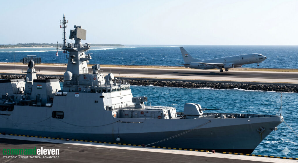
The geopolitical fragmentation of the Chagos Archipelago has accelerated the integration of adjacent regional maritime surveillance networks, specifically positioning India’s newly operationalized military infrastructure on North Agalega Island as the primary southwestern sentinel of the Indian Ocean Region (IOR). Developed under a confidential bilateral security envelope between New Delhi and Port Louis, the Agalega facility acts as a force multiplier for Indian Maritime Domain Awareness (MDA) while functioning as a complementary radar and staging node to the US-UK installations on Diego Garcia.
Infrastructure Capabilities of North Agalega
The transformation of North Agalega from an isolated littoral outpost into a forward operating base (FOB) features highly specific military engineering specifications designed to sustain long-range maritime patrol aircraft (MRMPA) and surface combatants:
- Airstrip Architecture: The facility features a reinforced 3,000-meter (9,840-foot) concrete runway configured with expanded turnaround aprons and optimized taxiways. This footprint specifically accommodates continuous high-load operations by the Indian Navy’s Boeing P-8I Neptune (Poseidon variant) aircraft and the Indian Air Force’s C-130J Super Hercules transport fleets.
- Deep-Sea Berthing Infrastructure: The northern tip of the island features a newly constructed, deep-water naval jetty extending directly into deep littoral channels. The jetty provides adequate draft (~12 meters) and reinforced mooring bitts to support the berthing and replenishment of frontline surface combatants, including Talwar-class guided-missile frigates and Visakhapatnam-class stealth destroyers.
- Sensor and Hangar Arrays: High-resolution structural profiles indicate the deployment of climate-controlled, reinforced aircraft hangars equipped with localized technical diagnostic links. This is paired with an integrated Coastal Radar System (CRS) array and automated trans-horizon high-frequency (HF) communications domes that channel real-time surface track data directly into the Information Fusion Centre – Indian Ocean Region (IFC-IOR) based in Gurugram, India.
The Agalega-Diego Garcia Surveillance Net
The geographic alignment between North Agalega and Diego Garcia establishes a highly effective maritime choke-point interception net. Operating from Agalega, Indian P-8I aircraft execute continuous, automated search-and-track orbits dominating the Mozambique Channel and the southern approaches of the Cape of Good Hope shipping routes.
Through formal intelligence-sharing protocols solidified in early 2026, data links from Indian P-8I Neptune assets and forward-deployed MQ-9B SeaGuardian uncrewed aerial systems (UAS) are directly cross-leveled with US Navy maritime operations centers on Diego Garcia. This tactical synthesis creates a unified sensor wall across the southwestern Indian Ocean, allowing for the real-time tracking of foreign undersea and surface combatants well before they approach critical trade arteries or strategic exclusion zones.
Anti-Access/Area-Denial (A2/AD) Dynamics and Peer-Competitor Counter-Strategies
The strategic utility of Diego Garcia and the expanded Agalega axis is increasingly challenged by the asymmetric and conventional Anti-Access/Area-Denial (A2/AD) strategies deployed by the People’s Liberation Army Navy (PLAN). As China intensifies its power projection across the IOR under its “String of Pearls” and broader Indian Ocean outreach frameworks, the central oceanic facilities face a multi-tiered offensive and electronic threat matrix.
Peer-Competitor Forward Staging and Logistics Nodes
The PLAN has consolidated an operational network of civilian-commercial dual-use ports and formal military installations designed to bracket the Chagos-Agalega surveillance corridor:
- Doraleh, Djibouti: The formal PLAN support base at Djibouti has been upgraded with a 400-meter blue-water pier capable of berthing Type 055 guided-missile destroyers and Type 003 aircraft carriers, providing a permanent logistics and electronic command-and-control (C2) footprint at the western edge of the axis.
- Gwadar (Pakistan) and Ream (Cambodia): These facilities provide the PLAN with critical technical intelligence (TECHINT) gathering positions and potential wartime forward ammunition depots, compressing the reaction timelines for US and allied naval assets operating out of Diego Garcia.
Undersea Infiltration and Acoustic Evasion Protocols
To counter the highly sensitive acoustic monitoring arrays,including the updated Sound Surveillance System (SOSUS 2.0) networks managed from Diego Garcia,the PLAN employs advanced subsurface deployment protocols:
- Acoustic Masking in Deep Trench Corridors: PLAN Type 093B nuclear-powered attack submarines (SSN) and Type 039C conventional air-independent propulsion (AIP) submarines utilize the complex thermal layers and high-ambient-noise channels of the Ninetyeast Ridge and the Sunda Trench to mask their acoustic signatures. By mapping regional bathymetric anomalies, these hulls routinely slip beneath standard active/passive sonar detection envelopes.
- Uncrewed Undersea Glider Deployment: The PLAN regularly deploys swarms of “Haiyi” (Sea Wing) autonomous underwater gliders across the central Indian Ocean. These low-acoustic-signature systems gather continuous oceanographic data,including temperature, salinity, and current profiles,which is compiled by naval hydrographic centers to optimize sonar propagation algorithms for Chinese submarines while identifying blind spots in the Western atoll-based passive hydrophone arrays.
Targeted Kinetic and Electronic Counter-Measures
In a high-intensity contingency scenario, the physical infrastructure of Diego Garcia and Agalega faces highly specialized precision threat vectors:
- Long-Range Precision Strike Vectors: The PLAN Rocket Force (PLARF) maintains forward-deployed inventories of DF-26B and DF-27 intermediate-range ballistic missiles (IRBM), colloquially designated as “carrier killers” and “atoll busters.” Launching from mobile garrisons in southern China, these hypersonic-velocity systems deploy maneuverable re-entry vehicles (MaRVs) capable of striking the fixed airfield coordinates, hangar envelopes, and fuel hydrant infrastructure of Diego Garcia within an operational window of less than 18 minutes.
- Electromagnetic and Cyber Operations: Dedicated Chinese electronic warfare vessels and localized signals intelligence (SIGINT) trawlers operating under commercial fishing flags systematically deploy high-power broadband jamming matrices targeting the satellite communication (SATCOM) uplinks of the GEODSS system on Diego Garcia. These counter-measures focus on injecting deceptive signaling protocols into the regional Beidou/GPS crossover networks, seeking to degrade the precision tracking capabilities of allied multi-domain assets during active naval maneuvers.
Undersea Cables, Cyber-Kinetic Vulnerabilities, and Electromagnetic Spectrum Operations (EMSO)

The geostrategic position of Diego Garcia and the expanded Agalega axis depends fundamentally on a vulnerable matrix of undersea fiber-optic telecommunications cables and localized satellite downlink architectures. In modern multi-domain warfare, the defense of these physical data pipes and the control of the surrounding Electromagnetic Spectrum (EMS) represent the critical operational baseline required to maintain command-and-control (C2) integrity across the Indian Ocean Region (IOR).
Undersea Cable Architecture and Interception Vulnerabilities
Diego Garcia is tied into global strategic networks via a highly isolated subsea cable infrastructure, primarily routed through specialized branching units connected to the primary trans-oceanic cables traversing the seabed between Southeast Asia and the Middle East.
- Physical Routing Constraints: The data backbone of the atoll relies on specialized submarine cable landing stations (CLSs) heavily fortified against physical kinetic strikes. However, the physical cable lines must traverse shallow littoral waters and deep-ocean chokepoints where they become highly vulnerable to deep-submergence intervention assets.
- Subsea Interception Protocol Indicators: Chinese oceanographic research vessels (such as the Xiang Yang Hong series) and specialized naval salvage hulls regularly deploy uncrewed remotely operated vehicles (ROVs) equipped with optical tap-splicing matrices. Analysts track these operations via specific signature indicators: sudden, localized deviations in commercial automatic identification system (AIS) telemetry over exact cable path coordinates, followed by micro-attenuation events or signal-to-noise ratio (SNR) fluctuations registered on allied network monitoring equipment.
Electromagnetic Spectrum Operations (EMSO) and Electronic Warfare
The high density of satellite communication (SATCOM) and radar architecture on Diego Garcia creates a complex electromagnetic footprint that both sides seek to exploit or degrade.
- High-Frequency Direction Finding (HFDF) and SIGINT Interdiction: The base operates advanced HFDF arrays designed to intercept and triangulate hostile naval communications across the IOR. To counter this, peer-competitor vessels deploy low-probability-of-intercept/low-probability-of-detection (LPI/LPD) frequency-hopping protocols alongside localized noise-jamming transmitters designed to blind the atoll’s sensitive signal collection arrays.
- Satellite Communications Jamming: During periods of heightened tactical readiness, specialized Chinese electronic warfare assets operating out of regional maritime nodes deploy targeted radio-frequency (RF) jamming counter-measures against the Ka-band, Ku-band, and X-band uplink blocks utilized by the US military’s Wideband Global SATCOM (WGS) system. This electromagnetic interference seeks to disrupt the high-bandwidth data streams feeding real-time target coordination tools, forcing allied platforms to degrade into lower-yield, legacy UHF tactical satellite links.
- High-Altitude Electromagnetic Pulse (HEMP) Protection: Because a high-altitude nuclear detonation or a specialized non-kinetic high-power microwave (HPM) strike could cripple the base’s unshielded digital nodes, Diego Garcia’s critical C2 facilities have been retrofitted with military-grade electromagnetic shielding. This includes the installation of copper-shielded Faraday cages, high-speed surge arrestors on all incoming power lines, and fiber-optic interior data networks designed to isolate internal circuitry from massive, induced voltage transients.
Logistics Prepositioning, Autonomous Fleet Support, and Cross-Theater Sustainment
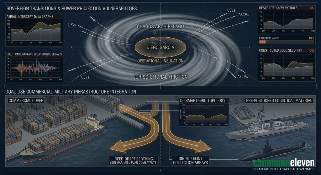
Diego Garcia functions as the primary forward logistics and sustainment platform for the United States Military Sealift Command (MSC) and combat fleets operating across both the USCENTCOM and USINDOPACOM areas of responsibility. The atoll’s capability to store, maintain, and rapidly distribute immense stockpiles of heavy military hardware, munitions, and fuel underpins the structural sustainability of any western military response to an IOR contingency.
Maritime Prepositioning Ships Squadron Two (MPSRON-2)
The core logistical engine of the atoll is the permanent forward deployment of Maritime Prepositioning Ships Squadron Two (MPSRON-2) within the deep-water lagoon anchorage.
- Squadron Composition and Material Capacity: MPSRON-2 consists of multiple heavily specialized roll-on/roll-off (RO-RO) cargo vessels, container ships, and aviation logistics support vessels. These hulls are permanently loaded with the complete combat equipment, ammunition, medical assets, and sustainment rations required to support a Marine Expeditionary Brigade (MEB) for up to 30 consecutive days of high-intensity operations.
- Rapid Offload and In-Stream Transfer Protocols: The lagoon is optimized for “in-stream” cargo transfer operations, allowing ships to discharge heavy combat vehicles, artillery pieces, and ammunition onto specialized lighterage systems and landing craft even in high sea-state conditions. This logistical capability ensures that combat equipment can be married with flown-in personnel at forward littoral staging zones within an operational window of less than 72 hours from execution order.
Autonomous Fleet Maintenance and Drone Logistics
To meet the evolving operational requirements of 2026 maritime warfare, Diego Garcia has integrated advanced autonomous logistics and maintenance infrastructures into its traditional naval support yards.
- XLUAV and UUV Maintenance Facilities: The naval support facility features newly constructed, climate-controlled robotic maintenance bays optimized for the servicing, modular reconfiguring, and battery-swapping of extra-large uncrewed underwater vehicles (XLUAVs). These specialized docks use automated diagnostic links to check hull integrity, clean acoustic sensor faces, and reload modular undersea mine-laying payloads without requiring human divers.
- Uncrewed Aerial Cargo Logistics: The base has operationalized a localized network of heavy-lift uncrewed cargo aerial systems (UAS). These autonomous platforms execute automated ship-to-shore and atoll-to-atoll material distribution missions, delivering critical high-value spare parts, electronic components, and medical supplies to forward-deployed surface combatants and remote monitoring stations within a 500-nautical-mile radius without risking manned transport aircraft.
- Strategic Cross-Theater Refueling Coordination: Through integrated digital logistics tracking networks, Diego Garcia coordinates the deployment of fast combat support ships (AOE) and fleet replenishment oilers (TAO). By functioning as a secure bulk fuel depot that links directly into the Western regional energy supply chains, the atoll guarantees that carrier strike groups (CSG) transitioning between the Western Pacific and the Persian Gulf maintain uninterrupted operational momentum.
Sensor Integration, Multi-Domain Acoustic Tracking, and Space Domain Awareness (SDA)
The survival and operational efficacy of Diego Garcia rely on its capacity to serve as the primary sensor data fusion node for United States Space Command (USSPACECOM) and United States Indo-Pacific Command (USINDOPACOM) in the Southern Hemisphere. The atoll hosts an dense array of multi-domain tracking systems designed to monitor threat trajectories ranging from deep-space orbital vectors to low-frequency subsurface acoustic signatures.
Subsurface Acoustic Monitoring and Sensor Arrays
The deep ocean basins surrounding the Chagos Trench and the broader central Indian Ocean are heavily seeded with passive and active sensor architectures configured to deny acoustic camouflage to peer-competitor submarines:
- Fixed Hydrophone Arrays and SOSUS 2.0: The seafloor surrounding the atoll is integrated with localized nodes of the updated Sound Surveillance System (SOSUS 2.0). These deep-water acoustic arrays are anchored directly into the sound channel (SOFAR channel), capturing low-frequency acoustic emissions from transit hulls. The data streams are processed locally via advanced spectral analysis algorithms to isolate machinery harmonics from background ocean noise.
- Surveillance Towed Array Sensor System (SURTASS): Diego Garcia acts as the primary replenishment and data-downlink hub for ocean surveillance ships (such as the Impeccable and Victorious classes, operating the AN/UQQ-2 system). These vessels deploy multi-kilometer twin-line passive and active low-frequency towed arrays through the deep-water choke points of the Sunda and Lombok straits, transmitting real-time tracking data via secure satellite links back to the Diego Garcia Naval Support Facility.
Space Domain Awareness (SDA) and Strategic Optics
Perched at a critical geographic latitude, Diego Garcia provides unhindered line-of-sight tracking into deep-space orbital corridors, making it a critical node for global space security architectures:
- GEODSS Site 3 Infrastructure: The installation hosts Node 3 of the Ground-based Electro-Optical Deep Space Surveillance (GEODSS) system, operated by the US Space Force. This asset utilizes three co-located, high-aperture tracking telescopes equipped with intensified charge-coupled device (CCD) sensor matrices. The system is engineered to detect, identify, and track deep-space objects and foreign military satellites operating in geosynchronous Earth orbit (GEO) at distances exceeding 35,000 kilometers.
- Space Force Tracker Integration: The optical tracking data gathered by GEODSS is integrated with high-frequency telemetry from the local space tracking radar array. This integrated data stream provides real-time orbital mechanics profiles and anomaly detection directly to the Unified Space Operations Center (USSpOC), tracking foreign direct-ascent anti-satellite (ASAT) weapons and monitoring peer-competitor co-orbital maneuverable satellites.
Future Projections, Coalition Interoperability Challenges, and Escalation Scenarios (2026–2030)
The strategic baseline of the Chagos Archipelago and forward littoral bases like Agalega faces an increasingly volatile operational environment looking toward the 2030 horizon. The collision of shifting legal frameworks, rapid autonomous hardware deployment, and peer-competitor power projection indicates critical friction points for Western and coalition naval planning.
The Legislative Impasse and Strategic Vulnerabilities
The operational envelope of Diego Garcia has entered a period of acute legal and structural uncertainty following developments in early 2026:
- The Treaty Deep Freeze: Following intense political friction between London and Washington, the United Kingdom government was forced to shelve the domestic legislation intended to implement the 2025 UK-Mauritius Treaty. This legislative pause was triggered after the second Trump administration officially withdrew its formal support for the sovereignty transfer, labeling the cession of the archipelago a critical strategic liability that would compromise US operations against regional adversaries.
- Bilateral Friction and Access Risk: Because the US refused to execute the formal exchange of letters required to amend the foundational 1966 US-UK bilateral agreement, the treaty remains frozen. While this effectively maintains short-term Anglo-American control over the atoll, it introduces severe long-term operational friction with Port Louis. Mauritius maintains that its de jure sovereignty over the Chagos Territory is non-negotiable under international law, raising the risk of future Mauritian air-space denials and legal challenges targeting allied long-range bomber flights staging from Diego Garcia during Indian Ocean contingencies.
Emergent Asymmetric and Autonomous Threat Vectors
| Threat Scenario | Operational Vulnerability Vector | Strategic Coalition Impact |
| Swarm-Based Uncrewed Infiltration | High-density deployment of low-cost PLAN loitering autonomous surface vessels (ASVs) and underwater gliders. | Saturation of passive acoustic hydrophone networks; physical compromise of undersea data cables; degradation of the base’s immediate defensive screening perimeter. |
| Hypersonic Electronic Blockade | Hypersonic cruise missiles equipped with non-nuclear High-Power Microwave (HPM) payloads launched from long-range PLAN H-6N bombers. | Instantaneous degradation of unshielded communications telemetry; blindness of the GEODSS space surveillance sensors; temporary disruption of automated command links. |
| Coalition Interoperability Failures | Misalignment of secure data-link standards between US Navy assets and Indian Navy surveillance nodes at Agalega. | Inability to form a common operational picture (COP); creation of seam-space vulnerabilities that hostile subsurface assets exploit to bypass the Chagos-Agalega radar wall. |
The Indispensable Anchor
Despite the mounting legal, electronic, and kinetic challenges, Diego Garcia remains an indispensable, non-relicatables strategic asset. Its deeply dredged lagoon, extensive strategic airfield capacity, dense sensor integration, and unparalleled storage reserves cannot be effectively duplicated by transient carrier strike groups or alternative littoral operating locations.
As peer-competitor navies transition into permanent blue-water deployment postures throughout the Indian Ocean Region, the preservation of unhindered command-and-control integrity at Diego Garcia,coupled with the seamless technical integration of forward staging nodes like Agalega,represents the definitive prerequisite for maintaining western maritime dominance and strategic stability across this critical global oceanic corridor.